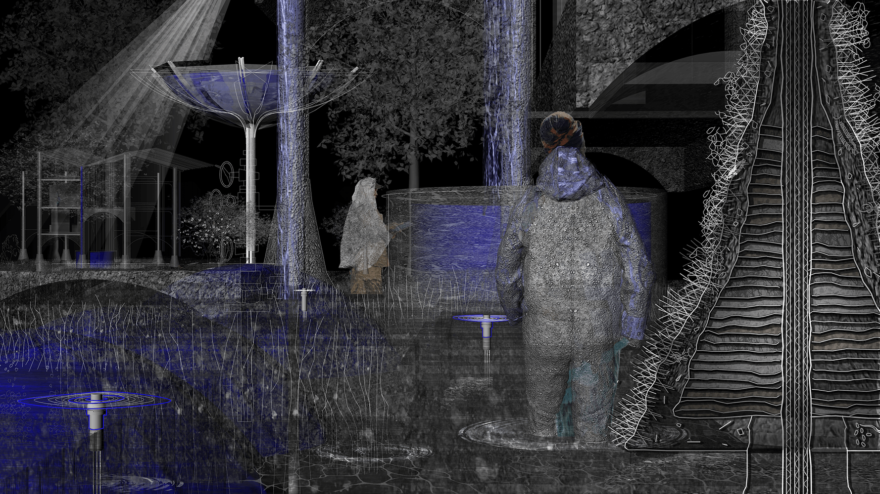
Water holds the past and present. Deciphering it´s layers, it mirrors decisions and the way land is acquired. The way current practices respond to water is defensive and results in impervious soils that redirect water somewhere else, destroying resilient networks and causing harm to the ones most vulnerable. These floods are consequences of a white governed property regime that has worked steadily towards the dispossession of people for the sake of western economy. It is undermining people’s intimate relationship to bodies of water; both natural and artificial. Atlanta is a city of water, sourced from ranges of the Appalachian Mountains and occurring rainfall. It sits on the mountain ridge of two watersheds. The land lies on a thick granite foundation, holding rich groundwater reservoirs. Yet Atlanta´s soil contains a lot of hard clay, which makes the infiltration of water difficult. Instead, the water tends to quickly run off to lower grounds. “Tracing roots “acknowledges the presence of water and re-imagines new conditions along sealed grounds in the watershed. Water is multiscale and immeasurable and as such destabilizes conventional planning practices. The diagram on the left shows a series of sections through the Intrenchment Creek Watershed in Atlanta. The existing built environment is marked in white. Water erodes property lines in the sealed soils, marked in gray. The water flow is decentralized, through the increased permeability of vegetation, which creates water sensitive typologies for future generations. Over time, more water is able to be absorbed in place, relieving both low lying areas as well as existing gray infrastructure.
A
AIA CES Credits
AV Office
321M Fayerweather Hall
Abstract Publication
415 Avery Hall
Academic Affairs
400 Avery Hall
Academic Calendar, Columbia University
Academic Calendar, GSAPP
Admissions Office
407 Avery Hall
1172 Amsterdam Avenue
New York, New York 10027
Advanced Standing Waiver Form
Must be printed and returned to 400 Avery Hall
Alumni Board
Alumni Office
405 Avery Hall
1172 Amsterdam Avenue
New York, New York 10027
Architecture Studio Lottery
Assistantships
Avery Library
300 Avery Hall
1172 Amsterdam Avenue
New York, NY 10027
Avery Review
Avery Shorts
B
Black Student Alliance at Columbia GSAPP
Building Science & Technology Waivers
Bulletin Archive
C
Career Services
300M Avery Hall
Columbia Books on Architecture and the City
Commencement
Communications Office
415 Avery Hall
Conversations podcast
Counseling and Psychological Services
Courses
Credentials Verification
Credit Transfer
Cross Registration
D
Dean’s Letter
Dean’s Office
402 Avery Hall
1172 Amsterdam Avenue
New York, NY 10027
Development Office
404 Avery Hall
Directory of Classes (All Columbia University)
Disability Services
Dodge Fitness Center
3030 Broadway Dodge
Dual Degree Program Requirements
E
End of Year Show
Events Office
415 Avery Hall
External Funding Sources
F
Faculty Directory
Feedback
Finance Office
406 Avery Hall
Fitch Colloquium
Future Anterior Journal
G
GSAPPX+
Grades
Graduation
Graphics Project
H
Honor System
Human Resources
Hybrid Pedagogy Resources
I
IT Helpdesk Ticket, GSAPP
IT Office, GSAPP
IT, Columbia University (CUIT)
Identity
International Students and Scholars Office (ISSO)
N
News and Press Releases
Newsletter Sign Up
Non-Discrimination Statement and Policy
O
Onera Prize for Historic Preservation
Online Admissions Application
GSAPP Admissions 407 Avery Hall
Output Shop
116 Avery Hall
1172 Amsterdam Avenue
New York, NY 10027
Ownership of Student Work Policy
P
Paris Prize, Buell Center
Paul S. Byard Memorial Lecture Series
Percival & Naomi Goodman Fellowship
Plagiarism Policy
Policies & Resources
Press Releases
Publications Office
415 Avery Hall
1172 Amsterdam Avenue
New York, New York 10027
R
Registration
Registration: Add / Drop Form
Room Reservations
S
STEM Designation
Satisfactory Academic Progress
Scholarships
Skill Trails
Student Affairs
400 Avery Hall
Student Awards
Student Conduct
Student Council (All Programs)
Student Financial Services
Student Health Services at Columbia
Student Organization Handbook
Student Organizations
Student Services Center
205 Kent Hall
Student Services Online (SSOL)
Student Work Online
Studio Culture Policy
Studio Procedures
Summer Workshops
Support GSAPP
Tracing Roots


